Just when we were developing some sense of cultural embarrassment about walking down the street while staring at a smartphone—and doubtless walking into people or telephone poles in the process—the tech gods have found a new way to keep us from watching where we’re going. My ten-year-old has been looking forward to the launch of Pokémon Go for months, but I didn’t expect his passion to be met by the many adults who now pace the streets while searching for a nearby Pokéstop.


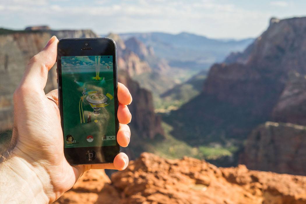
In case you’ve avoided the latest gaming craze, let me explain that Pokémon Go is an “augmented reality” game in which popular characters from the longstanding Japanese game Pokémon are superimposed on real-world streets and landscapes. These streets are dotted with Pokéstops: landmarks where a player can “check in” and obtain Pokéballs. (And thanks to Yelp’s latest search filter, you can even make a point of frequenting coffee shops or stores that have nearby Pokéstops.) By keeping an eye on the Pokémon Go interface, a player can spot the telltale rustling of a nearby Pokémon, who she can “capture” by tossing one of her Pokéballs at the creature. Once a player has captured enough Pokémon, she can train them at one of the many virtual Pokémon gyms that now cover our virtual landscape.
While many previous games and apps have experimented with augmented reality (AR) as a way of merging the virtual and physical worlds, Pokémon Go is the first AR experience to become a mass phenomenon. It’s hard for me to imagine that the game will sustain its current levels of interest and participation, at least among adults, but the speed of uptake and volume of coverage it has received will doubtless inspire many other efforts at tapping into the now-proven market for augmented reality experiences.
As the physical world starts to compete with (or extend) the screen as the arena for our digital gaming and exploration, the impact will be much greater than the mere inconvenience of navigating streets full of people who are staring down at their phones instead of at the sidewalks in front of them. What’s at stake is actually the future of how we perceive and experience geographic space itself, as we can see from a previous revolution in how people navigated the world around them: the advent of modern cartography.
In Mapping the Sovereign State, Jordan Branch credits the emergence of modern cartography with the very birth of the nation-state as we know it today. “In the modern international system, both the character of states and their interactions are structured by exclusive territorial sovereignty,” Branch observes.
This foundation—with linearly bounded territorial authority functioning as the dominant principle of political organization—is unique to the modern world and was the consequence of a complex transformation in early modern Europe. The development of modern cartography was a key part of this process: new mapmaking technologies changed how actors thought about political space, political organization, and political authority.
The key mapmaking innovation that drove this transformation, according to Branch, was the development of maps “filled with uniform, linearly bounded territories.” Because “maps depicted political authority as homogenously territorial and linearly bounded” at a time when political institutions did not yet reflect territorial control, they gave birth to “the treatment of political authority exclusively in terms of homogenous territorial areas separated by discrete boundary lines.” Nation-states didn’t create borders: the creation of borders gave birth to the idea of territorial nation-states.
If that seems like a grandiose claim to make on behalf of the world’s humble map-makers, it’s consistent with the way cartographic historians understand the role of maps. As Christian Jacob writes in Toward a Cultural History of Cartography,
One of a map’s basic purposes is to provide its users with a view or a model of geographical, cosmographical, metaphorical, conceptual, physical or metaphysical space…Maps are statements about the physical nature of the world, its shape and its limits. They display beliefs or concepts about the nature of the world and how it can be depicted. They express its physical and metaphysical organisation: its axes, its zones, favoured or unfavored.
For the adults and children who are now making their way through the physical world while searching for Pokémon, the Pokémon Go interface is defining geographic space just as much as a traditional map. That doesn’t mean we’re necessarily moving towards a world in which adherence to municipal or national boundaries have been replaced by affiliation with a specific Pokémon gym—although that would make a terrific premise for the next tween sci-fi blockbuster.
But it does mean we need to pay close attention to the experience of using Pokémon Go (or any other AR tool), considering its implications not just as a game but as a form of navigation. In the case of Pokémon Go, the most noteworthy feature is the absence of any street names: your only navigation clues are nameless blocks and intersections, and named landmarks. This makes Pokémon Go far closer to pre-cartographic navigation by landmark than to modern wayfinding via street names and addresses. Also absent: the discrete territorial boundaries that Branch argues were so consequential to the birth of the nation-state.
This nameless navigation is a logical extension of navigating by GPS rather than by route planning: yes, Waze and Google forewarn us to “turn left on State Street in half a mile,” but at the end of the day, we’re really just heeding the robotic voices when they prompt us to “turn left,” “turn right,” or “continue.” If this is how we navigate the world, how much longer will we need those street names at all?
Pokémon Go is preparing us—and more to the point, our kids—for a world in which GPS, driverless cars and location-aware mobile phones transform street names, place names and even maps themselves into quaint artifacts. Technology can now handle the location and navigation work for us; we no longer need to locate ourselves in order to get where we want to go.
Looks like all humans need to do is figure out where to go. With its ever-growing array of destination Pokéstops, however, Pokémon Go hints at a future in which we will be relieved of even that decision.