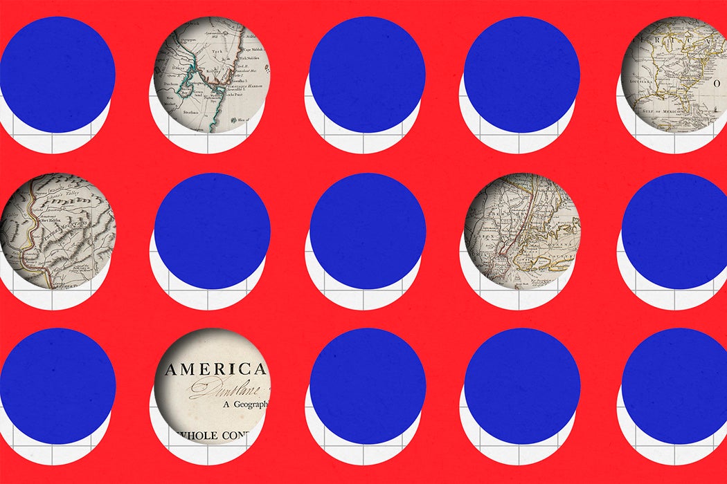
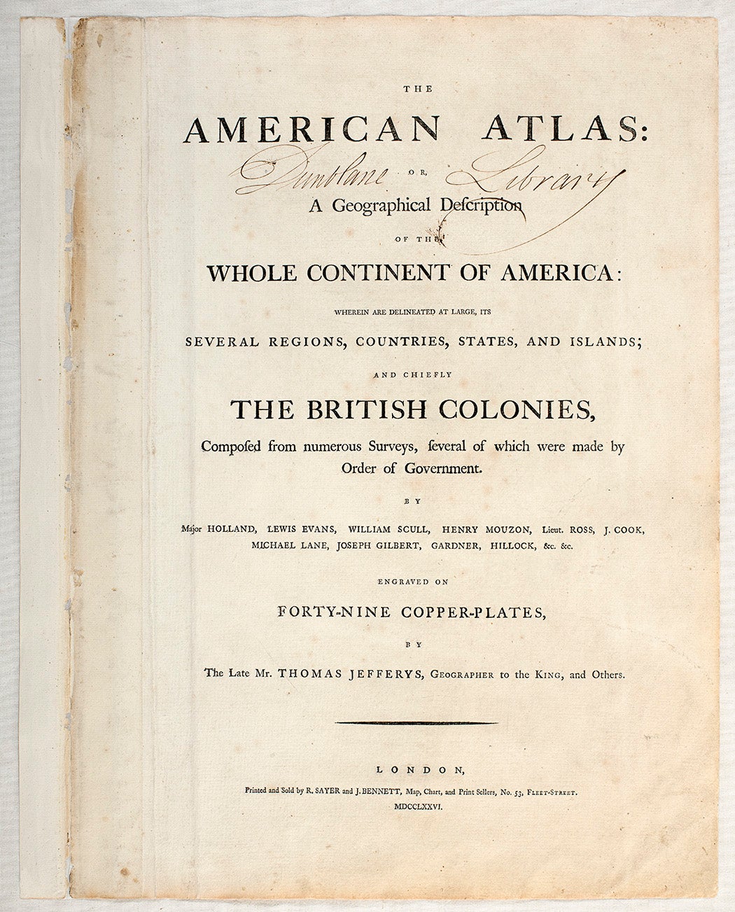
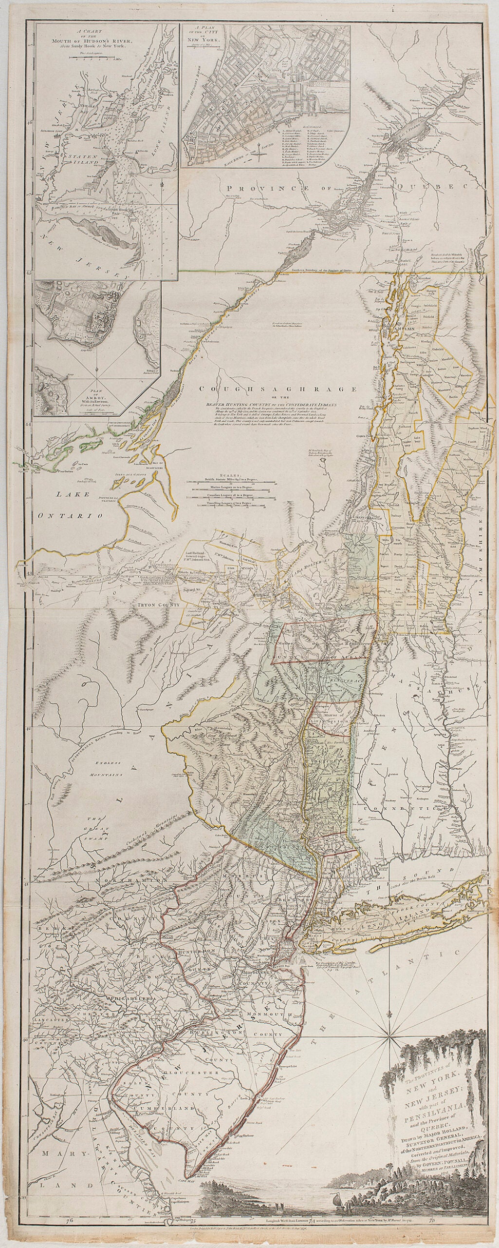
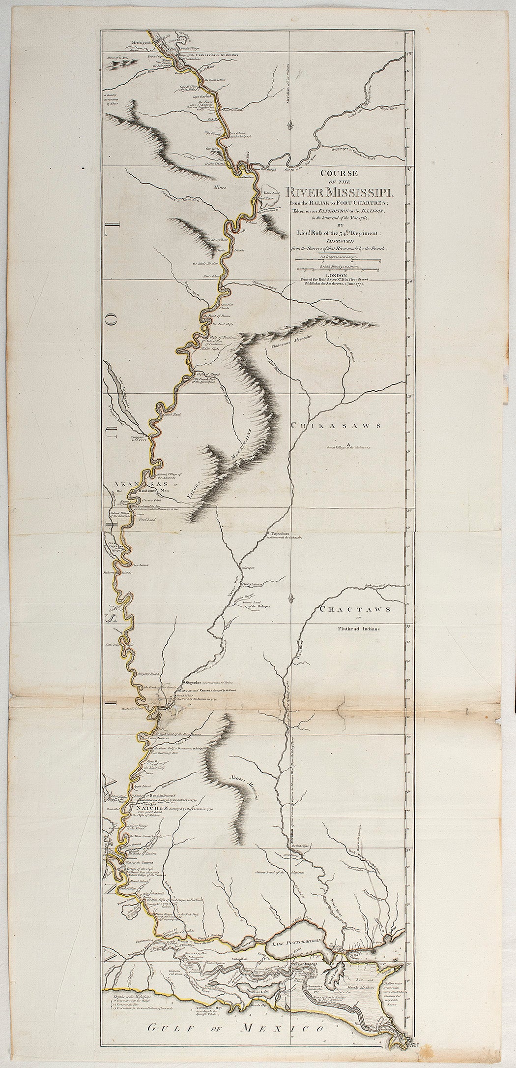
In the summer of 1775, shortly after George Washington took charge of the newly formed Continental Army in Boston, a small advertisement appeared in the London newspapers, announcing the publication of The American Atlas: Or, A Geographical Description of the Whole Continent of America. The volume—which bore the name of the late Thomas Jefferys, who had held the title of Geographer to the King—promised a view of the continent’s “several Regions, Countries, States, and Islands, and chiefly the BRITISH COLONIES.”


The atlas was designed to capitalize on public interest in the “rebellion,” as King George III would call it in an August 1775 proclamation. Through the war, the well-to-do English reader with two pounds, twelve shilling and six pence to spare could follow news from this faraway land across a series of maps. (In editions published in subsequent years, the maps even included descriptions of Britain’s tactical victories, such as at the Battle of Valcour Island in Lake Champlain.)
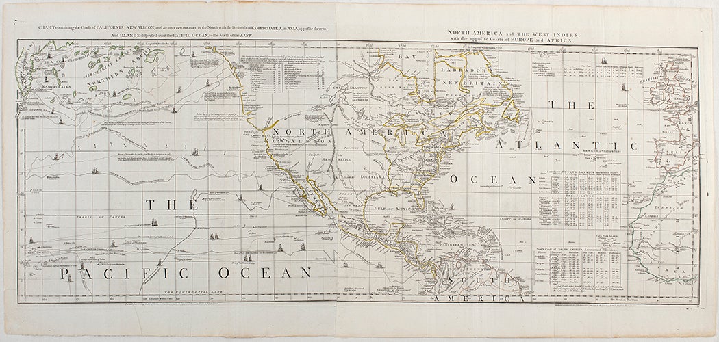
Two hundred and fifty years later, the modern reader can do the same, for free, thanks to a larger edition of the atlas, dated 1776, shared via JSTOR by the Leighton Library and the University of Stirling. As geographer Rita Ann Gardiner wrote for the Royal Geographical Society, this was the extent of “the knowledge of the topography of the New World available to London mapmakers in 1776.”
Meanwhile, in the colonies, Washington and the Continental Army struggled without the same trove of cartographic knowledge their enemy had collected over the previous decades. In January of 1777, Washington voiced this complaint to the Continental Congress. “The want of accurate Maps of the Country which has hitherto been the Scene of the War, has been a great disadvantage to me,” he wrote. “I have in vain endeavored to procure them, and have been obliged to make shift, with such Sketches, as I could trace from my own Observations and that of the Gentlemen around me.”
In the age of GPS and Google Earth, it is hard to imagine not knowing where you are or what is around the next bend, but maps like those collected in The American Atlas were invaluable resources in the 18th century and mapmaking was big business, especially during a war. Scholar Mary Pedley was surprised to discover that the London map firm Jefferys had been associated with before his death in 1771 did brisk trade with French clients in the midst of the Revolution.
Weekly Newsletter
"*" indicates required fields
The firm regularly sold maps to individuals associated with the Dépôt de la Marine, an official repository of maps for the French Navy, including nautical maps of Boston Harbor sent shortly after the start of the war. In March of 1778—the month France officially allied itself with the United States—French map engravers requested “all the new maps you have published.”
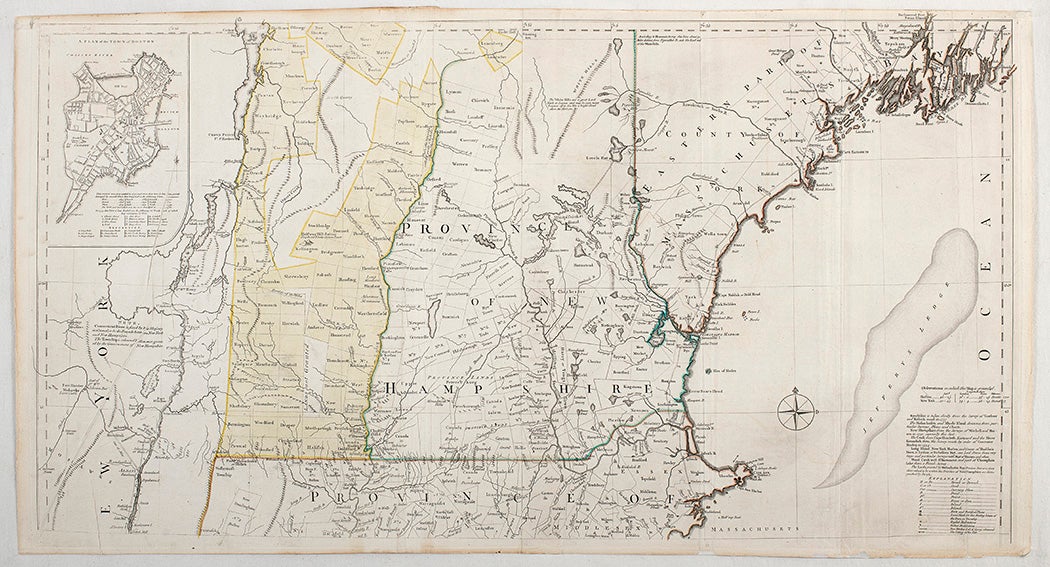
Such commercially available maps were vital to the war efforts on all sides of the conflict, though they were often based on surveys conducted a decade or two earlier. Writing about The American Atlas on the 200th anniversary of the United States’ declaration of independence from Britain, Walter W. Ristow, the head of the Library of Congress’s Geography and Map Division, asserted that “as a major cartographic reference work [The American Atlas] was, very likely, consulted by American, English, and French civilian administrators and military officers during the Revolution.”
Washington’s complaints aside, at least three of the 23 maps listed on the title page of the edition in the Leighton Library were created in whole or in part by colonists. Two of these map makers would go on to join the Continental Army. (Two others died before the start of the war: Joshua Fry, colonel of the Virginia regiment, whose death in 1754 elevated his second-in-command, George Washington to the leadership role; and Philadelphian Lewis Evans, a good friend of Benjamin Franklin, who was a godfather to Evans’ daughter.)
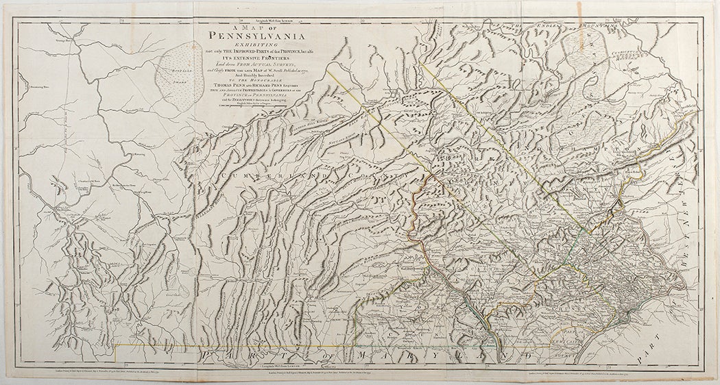
The map of Pennsylvania is a composite of two created by William Scull, a commissioned officer in the Continental Army and later a member of its Geographer’s Department, and Scull’s father. And the map of “the most inhabited part of Virginia” and its environs—the first created of the region by the new Virginians—was produced by Fry and one Peter Jefferson. Though Jefferson could not have imagined it at the time, the area on the map he and Fry marked as Watson, a small dot along the Patowmack River just south of The Great Falls, would become, not so many years after the publication of The American Atlas, the capital of a new country—a country his son, Thomas, would later lead.