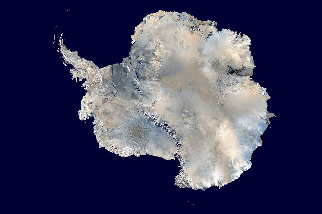
There’s no record of any human stepping foot on Antarctica before the beginning of the twentieth century. Exploration ramped up mid-century, particularly during the International Geophysical Year (1957–1958). The most complete imaging/mapping, meanwhile, is even more recent, from the late 1990s and early 2000s. So the polar continent, the fifth largest landmass on earth, containing 88 percent of the planet’s frozen water, is actually a fairly new addition to our ideas and conceptualizations of our planet.


We were just in time.
“Beginning in the 1970s, just as glaciologists seemed to be getting a handle on the ice with more refined theories and new technologies,” writes environmental historian Alessandro Antonello, “the complex effects of global warming began to complicate further scientific understands of the ice sheet.”
Antonello writes that it has almost exclusively been explorers and scientists who have built up the way the rest of us imagine Antarctica. “In many areas of environmental concern, scientists dominate the language, meanings, and narratives of discussion,” he writes, and this is especially so with Antarctica, where scientists have a near monopoly on physical presence.
The British Discovery Expedition of 1901–1904 made the first known human tracks on “the Ice” as it has often simply been called. They used hand-pulled sledges to make their literal and figurative marks. Like others who followed in the first decades of the century, the “Heroic Age” of Antarctic exploration, they found the environment extremely challenging. Robert Falcon Scott and his men reached the South Pole, found they been beaten there by Roald Amundsen, and froze to death on their way back home in 1912. The grandly titled Imperial Trans-Antarctic Expedition of 1914–1917, meanwhile, is best remembered as a self-rescue operation after the Endurance was crushed by the ice.
There was little Antarctic exploration between the two world wars, the first of which saw the deaths of numerous members of Endurance’s epically rescued crew. Snowmobiles—the first were military surplus tracked vehicles called Weasels—and aircraft greatly expanded post-WWII journeys into the continent. In 1956, just before the International Geological Year, there were 650 kilometers of transverse lines across the ice; by 1963, there were 30,000.
What Antonello calls “engagements” with the ice were much advanced by satellites like the Television Infrared Observation Satellite, Nimbus, Landsat, and the European Remote Sensing Satellite. The latter introduced interferometric synthetic aperture radar, InSAR, the “single most effective tool ever devised for detecting glacial change.” Unlike most places on Earth, satellite imaging typically preceded physical surveying. Major satellite image mosaics of the entire continent where made in 1997, 2005, and 2008 (the Landsat Image Mosaic of Antarctica is interactive).
On-the-ground (or ice) and remote sensing have led to the placing of Antarctica in time. The icy region developed around 34 million years ago, long preceding humanity, as the warm Eocene epoch turned into the cold Oligocene. The polar desert has been a constant of human history and a major factor in the global climate, even when nobody knew about it, but this seeming permanence is an illusion.
“Since the late 1960s, stability and instability, with ideas of collapse and disintegration, grew and morphed with the larger question of anthropogenic global warming,” writes Antonello.
Weekly Newsletter
"*" indicates required fields
A “once seemingly solid and immutable body of ice is now a fragile and precious one, a body with a diminished future.” The West Antarctic ice sheet (WAIS) in particular is unstable and, as such, is a potential major contributor to global warming-driven sea-level rise. In the 1960s, glaciologists first suggested the WAIS could collapse; since then “sustained mass loss”—it’s melting away—has been confirmed by remote sensing and other observational data.
In other words, we had barely gotten to know Antarctica before realizing that it’s in greater flux than at any other time in human history. The cryosphere, the Earth’s frozen water, is shrinking. A grim fact of global warming is that the Antarctic Peninsula, which reaches toward South America, is one of the fastest-warming regions on the planet.
And all that now-liquid water has to go somewhere.

