Think of a country. Now consider its capital. Why was this particular city chosen as such? Because it’s the most populous, as in Seoul? Because it represents the country’s economic center, like Tokyo? Because, like Rome, it’s full of history? Or because it resulted from a political agreement, as in Washington, DC?


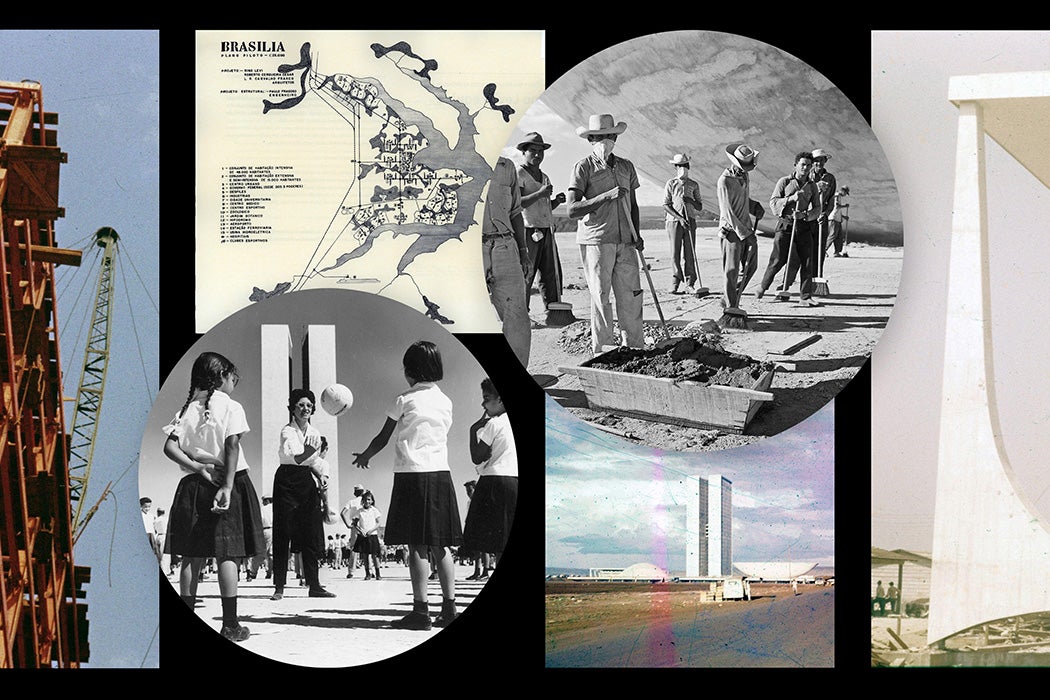
When we consider Brasília, the capital city of Brazil, we see a place that meets none of the above conditions and seems to make no sense. Brasília was built from scratch, in the middle of nowhere, in the hostile climate of the Cerrado—a savanna-like biome—hundreds of miles from any highway, railway, or airport. That the new capital was inaugurated in 1960, just four years after its construction began, makes it all the more impressive. Why would a country set out to build a capital city from scratch when one—Rio de Janeiro—already existed? Photographs and visual records preserved in Rice University’s Brasília Iconography collection and shared via JSTOR capture this ambitious undertaking as it unfolded.
The Idea
In a sense, the idea of Brasília predates Brazil itself. At the end of the eighteenth century, while the country was still a Portuguese colony, members of its independence movement, led by José Bonifácio de Andrada e Silva, suggested that the capital be transferred from the coastal Rio to São João del-Rei. The thinking was, explains J. V. Freitas Marcondes, that moving the capital inland would help develop an independent Brazil. It was an intriguing idea that simmered on a low boil for a few decades, until Brazil gained its independence in 1822, after which Andrada e Silva revived the idea of a capital transfer, coining Brasília as the name for the proposed new city.
Weekly Newsletter
For centuries, all of Brazil’s major cities were coastal. They were home to the ports out of which the region’s riches, including gold, sugar cane, and coffee, were exported across the Atlantic to Portugal. Moving the capital westward and inland would force the country to concentrate on developing industries and an economy that would benefit Brazilians, not Europeans.
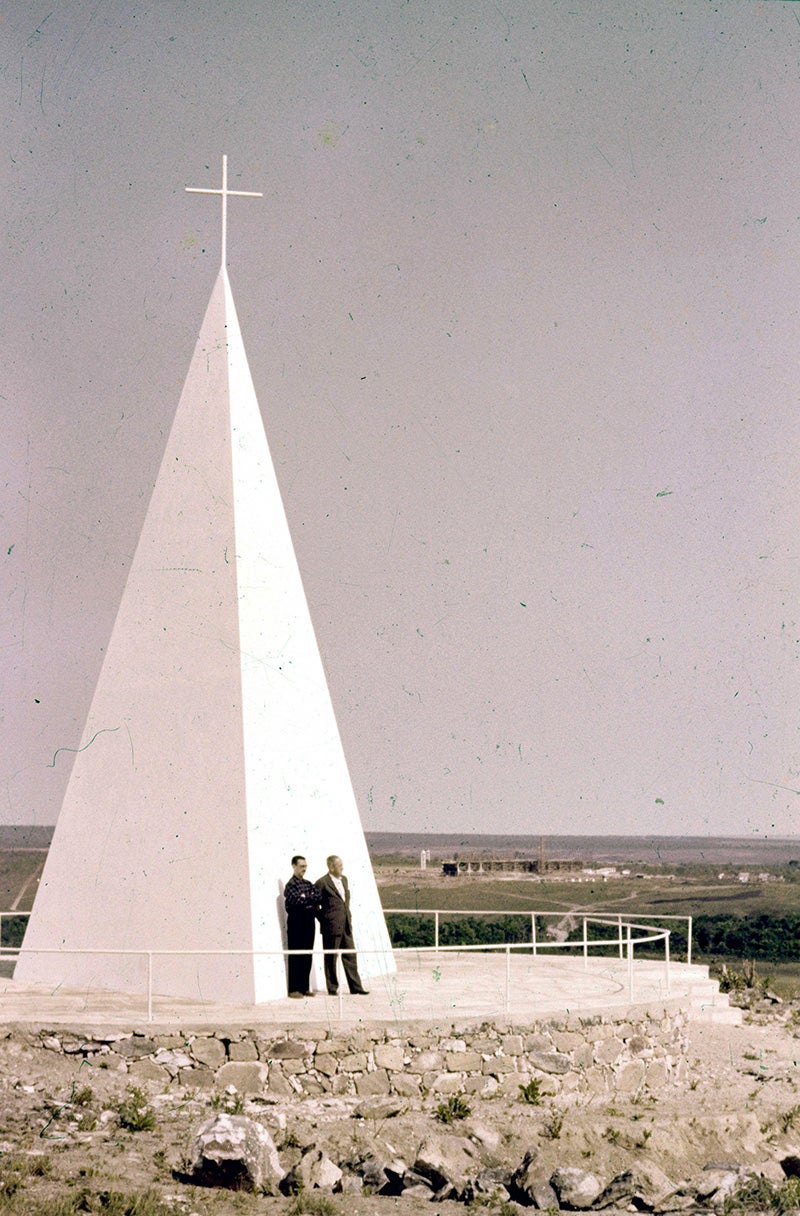
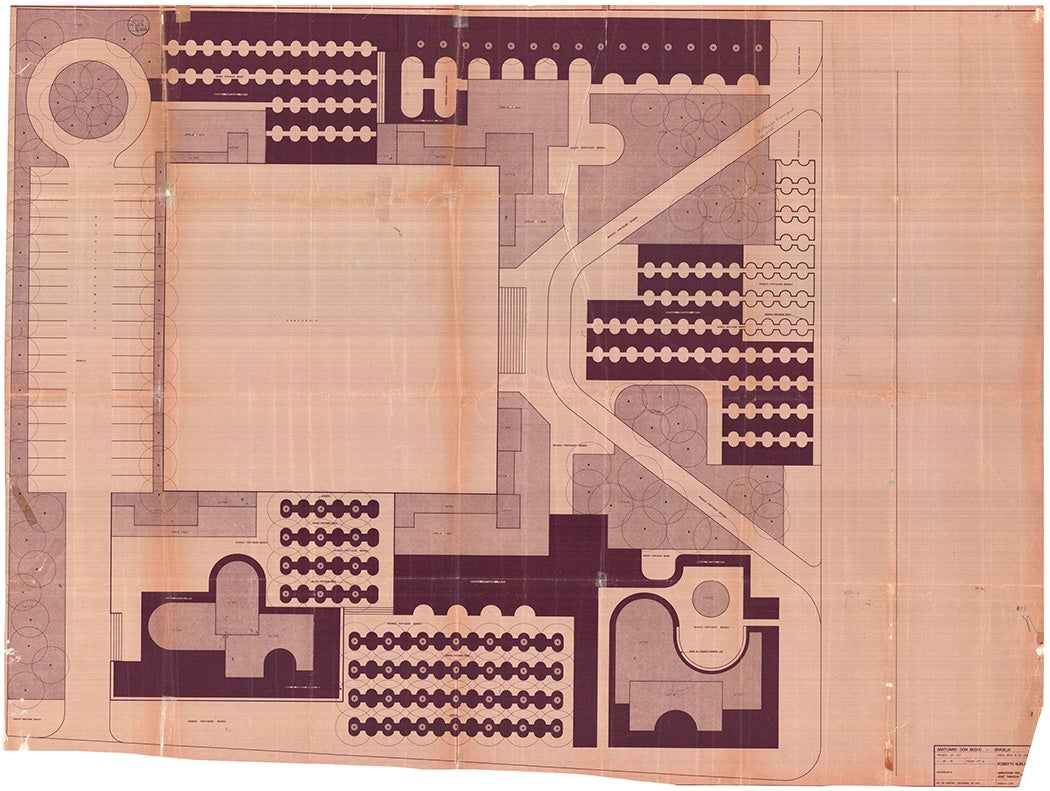
Yet not all the motivations for the construction of Brasília were political; some were mystical, even religious. One of its founding myths tells of a dream that Saint John Bosco had in 1883, in which he prophesized that the promised land would be built on the site where Brasília now stands. The story has become so ingrained in the imagination of Brazilians that even today, John Bosco is considered the capital’s patron saint, with both a chapel and a church named after him.
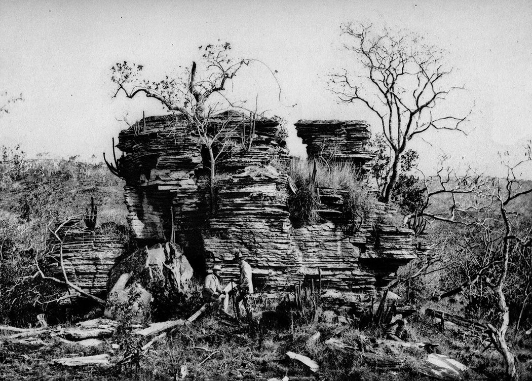
Despite its champions, the idea of an entirely new capital wasn’t taken seriously until the waning years of the nineteenth century. The country had to draft a new constitution to establish a commitment to build an inland capital. In the third article of the 1891 constitution, the state declared ownership of a region of 14,400 square kilometers (about 5,500 square miles), reserved for the construction of the new capital. Advocates of the new capital argued that it not only would promote national development, it would be strategically situated; in the event of a military conflict, the city—right in the middle of the country—could help unite the different regions of its territory.
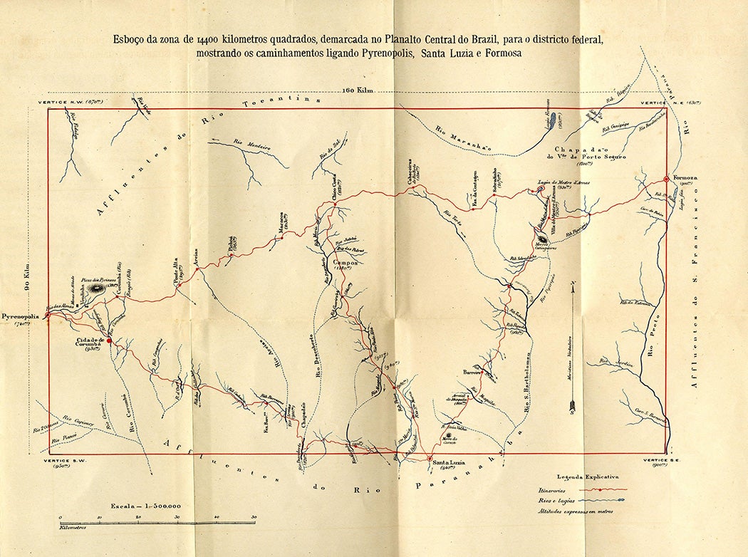
In 1892, astronomer and explorer Luís Cruls headed the Exploratory Commission of the Central Plateau of Brazil, which produced two reports indicating the best location for the city’s construction. The only thing still needed to get this project underway was sufficient political will. That took several decades to gather; the ups and downs of politics—including a period of dictatorship between 1937 and 1945—delayed the project, and it was only in 1956 that Brasília truly began to take shape.
Construction
During the 1955 presidential race, then-candidate Juscelino Kubitschek pledged to be the president to finally make Brasília a reality. He won the election and kept his word. In 1956, he created NOVACAP, the public company responsible for the city’s construction. In charge were Israel Pinheiro, an engineer, who later became the city’s first mayor, and Oscar Niemeyer, perhaps the most renowned architect in Brazilian history. Their first order of business was to organize a competition for designs of the city’s urban plan. Lúcio Costa, an urban planner, won with a design acclaimed almost unanimously by the judges. In his presentation, Costa made a point of reclaiming the ideals that originally motivated the project. Brasília, he argued, would not be the result, but rather the cause of regional planning, and it would lead to the development of the entire region. He proposed building the city around two perpendicular axes, resulting in a cross shape. In fact, topography made this impossible, and Costa had to curve one of the axes, resulting in the airplane shape that made his project famous.
In Costa’s vision, the city was to be divided into several sectors. Each had a specific function: housing, commerce, industry, entertainment, and administration, and, taking his cue from Kubitschek’s transportation policies, Costa prioritized cars as the main mode of transportation. To avoid traffic jams, the avenues that connect each sector of the city were designed without intersections; instead, the intersections have cloverleaf interchanges.
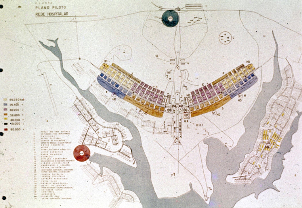
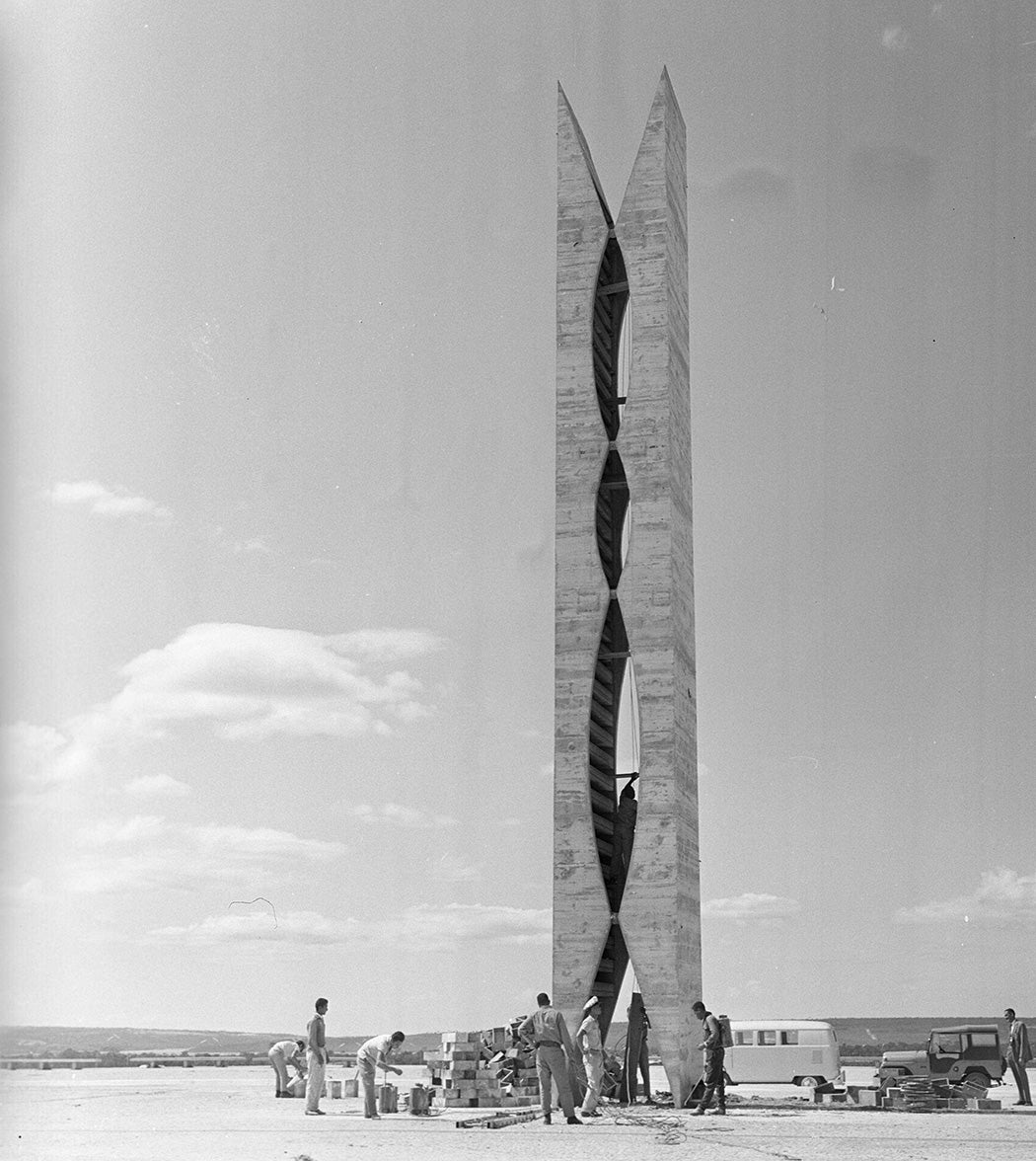
While Costa was planning the city, Niemeyer was responsible for designing administrative buildings and monuments. The influence of the titan of modern design, Le Corbusier, is evident in Niemeyer’s Palácio da Alvorada, for example, which was the official presidential residence; in the Congresso Nacional; and in the Catedral Metropolitana de Brasília, the site of presidential inaugurations. He was also responsible for the Memorial JK, a museum and cultural center in honor of the president who led Brasília’s construction.


The Cost
Building Brasília in so short a period was costly, though it’s difficult to ascertain an exact price tag given that many bureaucratic steps were cut in the interest of expediency, according to Ronaldo Costa Couto. But this doesn’t mean people failed to figure it out. Economist Eugênio Gudin calculated that it cost roughly $1.5 billion in 1954—or roughly 12.3 percent of Brazil’s GDP—to create this capital city. Adjusted for inflation, this is the equivalent of $16 billion today. Other estimates are far greater. In 1996, economist and journalist Ib Teixeira recalculated the cost, mindful of the fact construction in Brasília continued beyond the city’s inauguration in 1960. He found a result of a different order of magnitude: $155 billion at the time, or $316 billion adjusted for inflation.
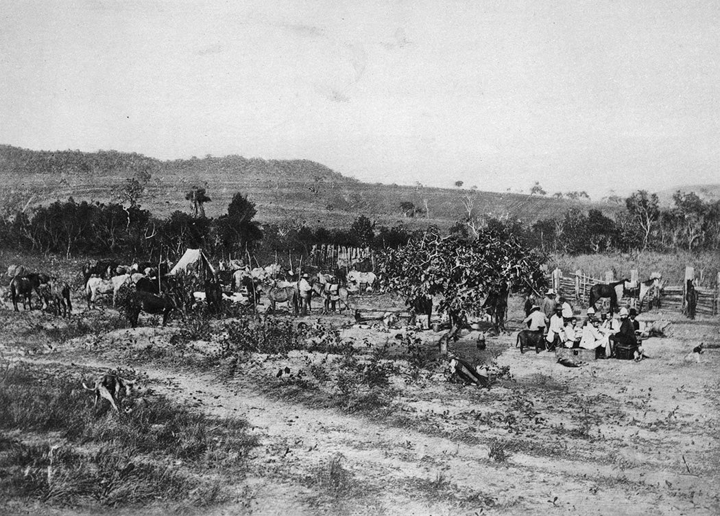
Transporting construction materials accounted for much of the cost of building the city. The only resources available on site were stone, sand, and bricks; the rest—such as tiles, rebars, and glass—had to be brought in from elsewhere. But highways only reached the site in 1960, and the nearest railway only went as far as Anápolis, about 90 miles away. The government didn’t want to wait for roadwork to be done before moving forward with the city’s opening, so it found the most expensive solution possible: air transport.
To cover this expense, the Kubitschek administration began printing more money and issuing public debt titles, resulting in a legacy of debt and inflation that plagued the country in the following decades.
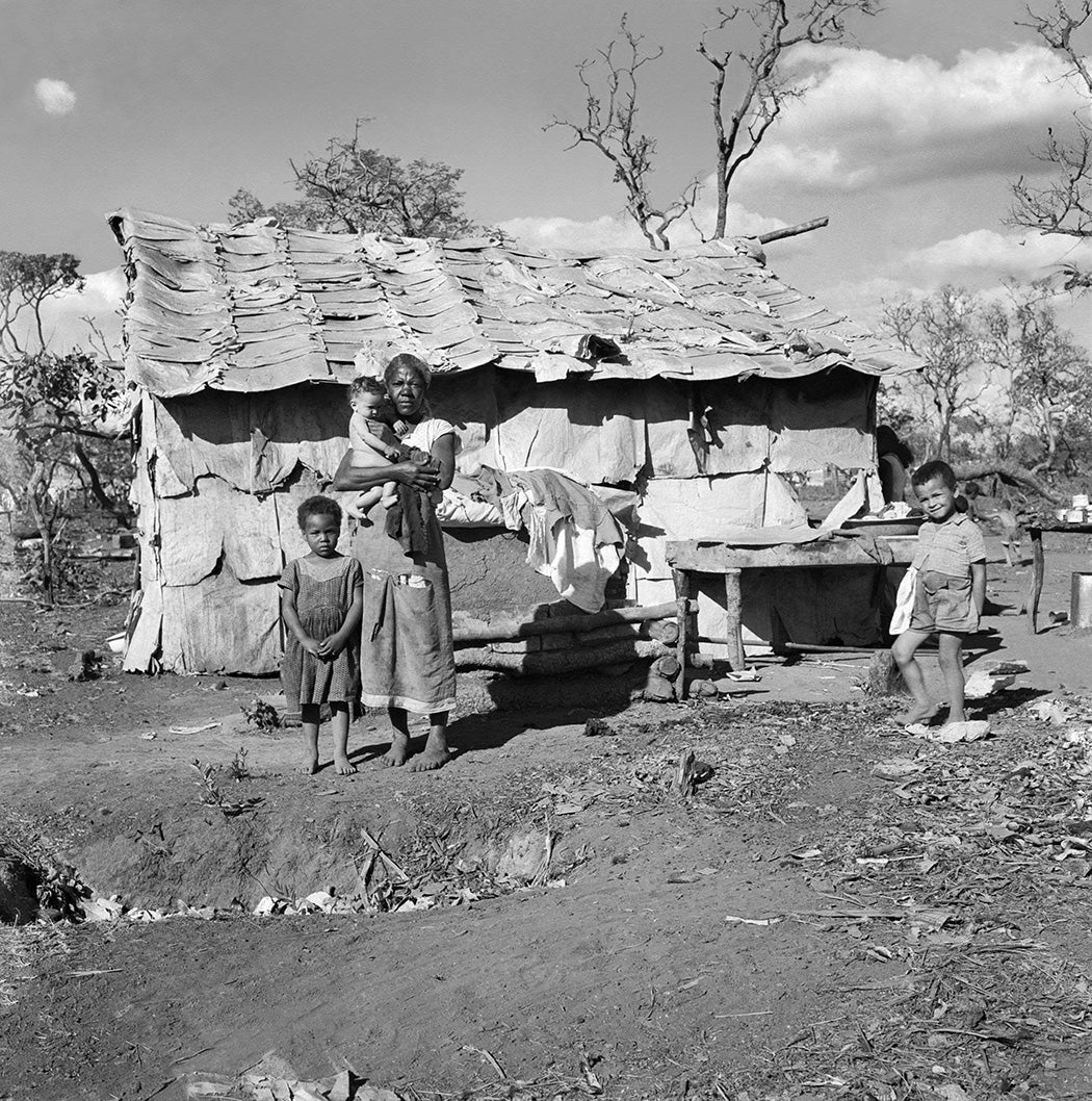
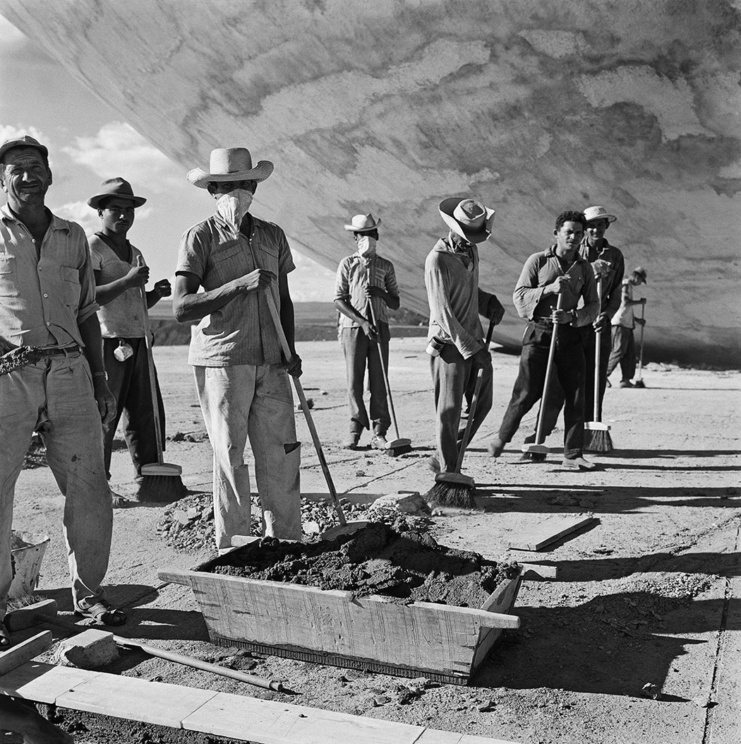
The human toll of building Brasília was also high. Tens of thousands of people from other regions of the country were sent to Brasília to work. A 1959 census indicated that there were approximately 64,000 people in the area, of whom more than 55,000 came from elsewhere and 54.5% were construction workers. Most of these workers—known as candangos—lived in precarious conditions. Bricklayers slept in communal rooms with no privacy, according to Gustavo Lins Ribeiro. They ate rotted food that sometimes led to intestinal infections.
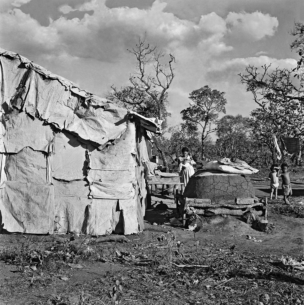
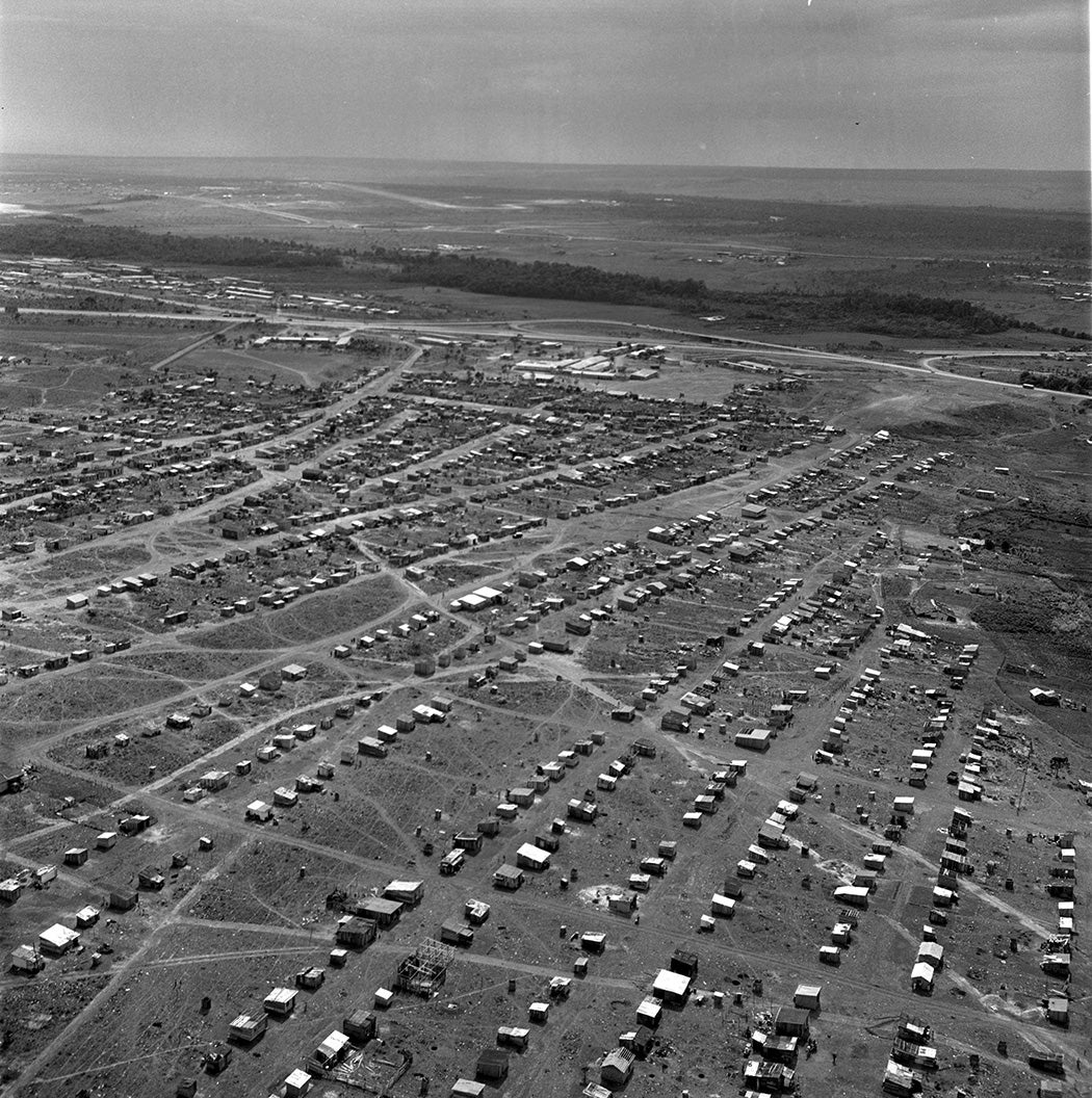
Some had no housing at all. Absent adequate living conditions, many workers improvised, illegally occupying areas outside the city and building themselves shelter with whatever materials were available. One such settlement was called Sacolândia (land of bags); another was Lonalândia (land of tarps). Many of these settlements endured even after construction of Brasília was completed. The largest of these sites was Vila do IAPI, so named for the IAPI Hospital, around which it formed, on the edge of the construction site. In 1971, the government enforced the evacuation of the area and created Ceilândia, an entirely new city for its residents.
Labor rights were routinely ignored. The practice of virada—exceeding overtime limits—was common. Protective equipment was also scarce, and there were frequent workplace accidents. There are few records of the total number of deaths and injuries during construction. Instead, we have spotty information. One of the available records is from the IAPI Hospital; it treated 10,927 construction-related accidents in 1959, an average of approximately 30 accidents per day. In 1960, this average exploded to 170 accidents per day.
To ensure public safety—and to suppress any protests that might arise related to poor working conditions—the government deployed the GEB (Guarda Especial de Brasília), security forces paid by NOVACAP, to oversee construction. The GEB became known for their brutality and lack of preparedness. It took part in the so-called Pacheco Fernandes Massacre on February 8, 1959, when workers at the Pacheco Fernandes construction company revolted against their bosses over spoiled food. Called to quell the laborers, the GEB used live ammunition against them. Experts agree on the sequence of events up to this point, but questions arise concerning the number of deaths and injuries that resulted from the action. While the official version states 48 injuries and only one death, witnesses and survivors say dozens were killed and their bodies were taken by truck to an unknown location.
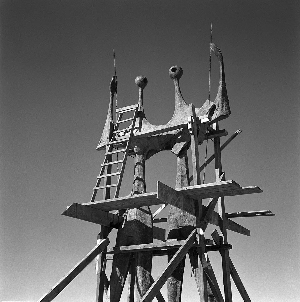
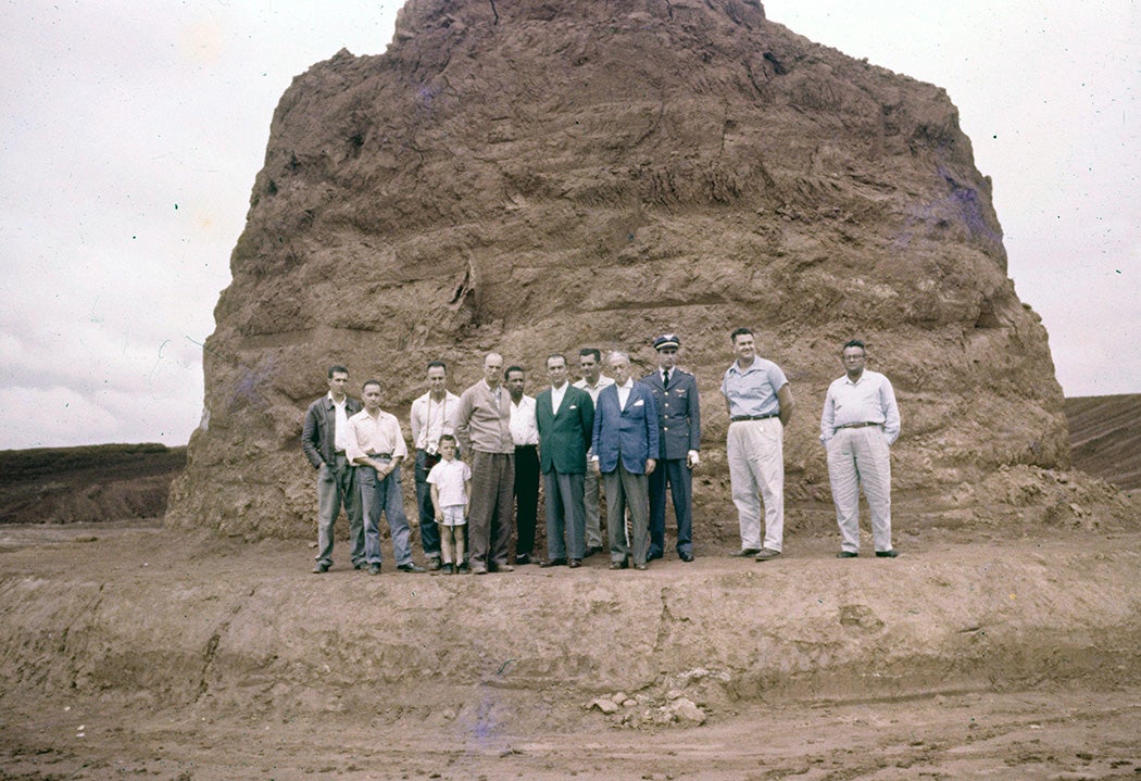
Although the term candango was initially used pejoratively, its nuance changed over time, and those referred to as such were considered with a measure of respect, indicating public recognition of their work and sacrifice. Today, the word is used as an alternative gentilic for people born in Brasília, and a monument called “Os Candangos” was built in 1959 representing them as warriors who made the city possible.
The Inauguration and Beyond
Brasília’s inauguration ceremonies began on April 20, 1960, with the handover of the city’s key to President Kubitschek. They continued until the early hours of April 21, concluding with a solemn mass. On that morning, the national flag was raised over the city for the first time, and a festive atmosphere prevailed, with workers and politicians, adults and children celebrating in the streets.


After the euphoria subsided, unpleasant realities set in. Brasília was far from complete. Many buildings stood empty, and others had not even begun to be built. Furthermore, the economic effects of the project were already being felt. President Jânio Quadros, who took office in 1961, had been an opponent of the project from the start, and he did little to continue the construction. One of the few buildings he worked to complete was the Pombal, but only at the request of his wife, Eloá Quadros, who directly asked Niemeyer to design it. Brasília’s construction was only officially completed in the early 1970s, when the embassies, which until then were still based in the former capital of Rio de Janeiro, were finally moved.
Did Brasília achieve its goal of promoting the development of Brazil’s inland? It’s undeniable that the highways and railways built to connect the capital helped develop the region’s agricultural sector, but this legacy is divisive, as many environmentalists associate it with the destruction of the Cerrado and an increase in greenhouse gas emissions. On the other hand, from a cultural perspective, there’s little doubt that the city represents an enormous contribution to urbanism and architecture. The achievement was internationally recognized in 1987, when the United Nations Educational, Scientific, and Cultural Organization (UNESCO) named the city a World Heritage Site, making it the only city built in the twentieth century to achieve this status. The same organization included Brasília on its list of creative cities in 2017 in the “design” category. It may not have been the reason Brazilians chose to create this capital, but it helped make the project worthwhile.