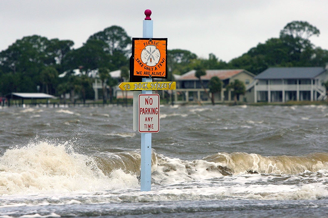
As ocean levels rise, littoral communities will need the ability to act and adapt quickly. For coastal urban areas, rising seas could be particularly catastrophic, flooding cities and reshaping the shoreline and way of life. Sea-level rise affects not only infrastructure, but cultural and built heritage as well.


As historic preservation scholars Sujin Kim and Morris Hylton III note in their study on communications surrounding sea-level rise, “Beyond individual property adaptation, preservation specialists must engage in community-wide dialogues on endangered urban heritage and comprehensive resilience planning.”
Kym and Hylton examined new techniques to more accurately assess the impacts of rising seas as well as how to better communicate potential hazards to community members, researchers, and policymakers alike. They identified three primary challenges for communicating information about sea-level rise to the general, non-specialist public. First, they found that ideas about possible hazards, such as urban flooding, tend to be based on past experiences of similar events. “This experience-based assessment can often lead to an underestimation of the impacts of extreme disasters,” they note.
A second communication challenge comes from the very complexity of climate change. Kym and Hylton write that “people see sea-level rise as a seemingly surreal subject, an abstract phenomenon viewed as a long-term event, occurring is the distant future… the invisibility of the hazard can undermine people’s awareness and concerns.”
Third, communication about the effects of climate change becomes bogged down in jargon and data, failing to engage “a wide-ranging public audience.” Thus, they suggest, the problem of preparing communities to address potential threats to cultural and built heritage is not just about accurately modelling and assessing those threats, but effectively sharing that knowledge with the people who will be affected by sea-level rise.
Kym and Hylton wanted to specifically integrate sea-level rise models with impact assessments from a historical preservation point of view. To do this, they developed a tool that integrated “terrestrial laser scanning with a cultural-resource survey approach that utilizes a geographic information system (GIS),” allowing them to integrate historical data alongside climate predictions. Their research focused on communities in the United States where city life is intertwined with material history, culture, and the coast.
The first pilot project in their study centered on Cedar Key, a small island off the Gulf Coast of Florida. Cedar Key’s downtown, a National Register Historic District, features buildings from the mid-nineteenth through the early twentieth centuries. The district has long been plagued with hurricanes and flooding, the frequency of which has increased as sea levels have risen.
More about climate communications
On the Side of Climate Solutions: An Interview with Paul Lussier

Making Climate Communication Nature-Driven

How Language and Climate Connect
At the outset of the project, a town leader and university researcher organized a series of public lectures. “Instead of immediate discussions on rising sea levels,” write the authors, “the lectures first explored a range of multidisciplinary water-related topics, from the town’s wildlife to its drinking water. They then discussed storms in the town’s history, using generic words like ‘hazard.’”
Building on the lectures, Kym and Hylton created digital and physical models of the town and the predicted sea rise, as well as videos that animated the potential changes. The models weren’t just for research; they were used to communicate the basics of sea-level rise to the community. “The models did not represent a specific projection, rather a general idea of rising sea levels,” the authors note.
Kym and Hylton shared the physical model at a public event, using the digital model to contextualize the information “by visualizing significant historic structures and primary intersections with virtual flooding.” Together, the models “helped enhance the residents relatability through familiar and realistic presentations. The residents were often impressed by the accurate, granular-level simulation of water behavior in the virtual town environment, saying that it ‘matched’ what they had witnessed.” People tended to compare sea-level rise to memorable disasters, using those past events to verify the information provided by the models.
Kym and Hylton write that the models helped inform the community and generated discussion on potential next steps, concluding that “the digital visualizations had been an effective method for sharing information.”
Weekly Newsletter
"*" indicates required fields
Models like those used in the Cedar Key project, essential for research, can be integral to science communication strategies. Scientific analyses are generally associated with complicated equations or difficult-to-interpret results. But the goal of the Cedar Key models, designed with cultural and architectural preservation in mind, was to encourage conversations that would lead to long-term collaborative urban planning.
Overall, the researchers found the models, combined with the public lectures, allowed residents to integrate data and their own experiences. As a result of this multi-pronged approach, “the residents and visitors contemplated the issue and discussed it with others. This engagement helped disseminate the information throughout the community and triggered discussions on the next steps.”