More than a century before the U.S. Civil War, between 1735 and 1737, Maryland and Pennsylvania had their own war, of sorts. The result of this conflict would be the survey of the Mason-Dixon line, a potent symbol of the separation between the North and the South. Its reasons for existing are, ultimately, a cartographic error, an inconsistency between two charters, which led to violence in the first half of the eighteenth century.


The instigator of that violence, Thomas Cresap, variously known as the “border ruffian” and the “Maryland Monster,” raided farms in York County as a duplicitous agent of the 5th Baron Baltimore, who demanded taxes from the Pennsylvania Dutch on the shores of the Susquehanna. A militiaman who claimed Pennsylvania’s magistrates had no jurisdiction over him, Cresap’s actions resulted in bloody confrontations between the two colonies.
Get Our Newsletter
"*" indicates required fields
Disagreement over Maryland and Pennsylvania’s mutual border began with the proprietary charter granted by King Charles II to William Penn. Inaccurate measurements and ambiguous language led to a dispute between the Quaker Penn family and the Catholic Calverts in Maryland. Penn’s charter stated that his colony’s southern border was the “beginning of the fortieth degree.” Baltimore’s charter, on the other hand, defined the northern extent of Maryland as being “that part of the Bay of Delaware on the north, which lieth under the fortieth degree.” Surveying tools being inexact, the topographers had grossly underestimated the distance of New Castle, Delaware to the fortieth parallel, which is what led to 22 miles of contested territory running east to west alongside the final border.
For 50 years this ambiguity was of minimal importance. By the 1730s, however, a growing settlement in the Susquehanna Valley, as well as Philadelphia’s transformation into British North America’s largest city, made the issue newly crucial. Regarding the line’s proper contour, the Penns reasoned that Pennsylvania extended to the fingers of the Chesapeake Bay. Charles Calvert argued that Maryland went as far as the fortieth parallel, and thus included the Quaker City itself. And so, long before Robert E. Lee’s Army of Northern Virginia invaded Pennsylvania, a conflagration broke out between two colonies founded in the name of tolerance during a series of incursions between 1736 and 1738, when Cresap raided the border country.
Following his apprehension by Pennsylvania forces in 1736, Cresap would be dragged through the streets of Philadelphia in steel shackles, having already developed a reputation for disagreeableness in the red-bricked provincial capital. Still, among the assembled there must have been some surprise at Cresap’s intransigence, when after his shameful parade the frontiersman declared in his native Yorkshire accent: “Damn it, this is one of the prettiest towns in Maryland!”
The historian Patrick Spero, writing in the Pennsylvania Magazine of History and Biography, notes that the word “’war’ might strike some today as an exaggeration,” but that the “causes underlying this conflict and the actions taken by both parties were similar to those seen” in other wars. Spero notes that both “Maryland and Pennsylvania mustered militias, built fortifications, and took prisoners” and that “most significantly, many of those involved in the fighting called it a war,” for this was a “conflict between two competing governments, each of which sought absolute… control over a disputed area.”
King George II and the Chancery Court intervened in 1738, temporarily setting the border at 15 miles south of the most southern residence in Philadelphia, until a more exact boundary could be set. A prisoner exchange was initiated. Skirmishes flared until 1767, when two neutral English astronomers, Charles Mason and Jeremiah Dixon, finished their four-year-long survey.
* * *
Spero notes that old belligerence is hard to forget, as even “[l]ater in the nineteenth century, [during] a time of pronounced state identity and allegiance, the war caused feuds between contending historians from Pennsylvania and Maryland.” Mason and Dixon’s survey charted the boundaries between two aristocratic families, but ultimately their task had far more cultural significance, an exercise in what the philosopher Henri Lefebvre calls “the production of space.”
The legal anthropologist Rosemary J. Coombe, writing in the Stanford Law Review, argues that space is not a “container but a medium through which identities are created. Maps, to the extent that they reify and objectify spaces, also legitimate particular subjectivities.” The Mason-Dixon line, based not on the course of a river or the shore of a lake, is an example of how an imaginary line on a map can “legitimate particular subjectivities.” Originally conceived as a means of differentiating that which belonged to Calvert and Penn, the line would come to symbolize the division between North and South, free-state and slave-state, separating America from itself.
As the historian Charles Desmond Dutrizac explains in The Pennsylvania Magazine of History and Biography: “In the eighteenth century, most English colonists on the North American mainland were uncertain about the physical limits of provincial jurisdiction.” But that borders exist is perhaps the one inviolate creed of the international political order. By contrast, it’s surprising how, during earlier periods, ambiguity was sometimes tolerated–until it wasn’t.
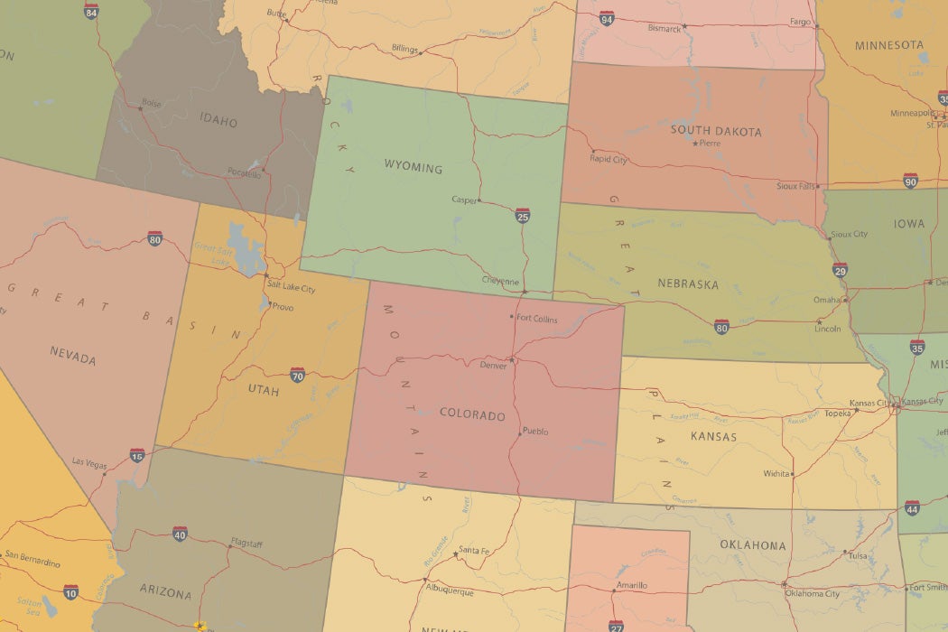
While the shared border of Maryland and Pennsylvania would become particularly culturally significant, it shares a quality with every other province and ultimately almost every American state: rectilinearity. Pennsylvania, excluding its eastern border on the Delaware River and the northwestern nub on Lake Erie, is a near rectangle. But in truth, all American states are essentially rectilinear, save Hawaii. This is obvious with the newer western states–Colorado, Wyoming, Utah. But examine a map of the United States and you’ll see, in contrast to European countries or English counties, that 49 of the states have a straight part of their border at some point, whether it’s the Florida panhandle, or western Massachusetts, or the four sides of California, with its long diagonal boundary with Nevada.
The geographer Harald Bauder writes in the Annals of the Association of American Geographers about one variety of border, explaining that “[c]oncrete ‘visual objects’ such as rivers, lakes, mountain ranges, and shorelines… often mark the border as a physical barrier.” Think of the Pyrenees separating France and Spain, or the meandering Rio Grande.
What’s interesting about the contested and ultimately agreed-upon border separating Pennsylvania and Maryland is how abstract its contours are, defined not by any river, lake, or mountain range. According to the Pennsylvania Charter, as granted by Charles II in 1681, the province’s southern boundary was to be calculated by a “[c]ircle drawne at twelve miles distance from New Castle Northward and Westward unto the beginning of the fortieth degree of Northern Latitude, and then by a straight Line Westward.”
Bauder notes that the “border is a polysemic and overdetermined geographical concept.” Yet examples from colonial American history concerning the politics of surveying demonstrate the contingency of borders. Borders in the medieval and early modern world didn’t carry the same significance that they do now; power was more decentralized, radiating outward towards fuzzy, liminal borderlands, where contesting fields of power overlapped.
The geographers Alexander C. Diener and Joshua Hagen remind us that “borders are not ‘natural’ phenomena” and that they “exist in the world only to the extent that humans regard them as meaningful.” In other words, no border, even a natural one, expresses anything other than the decisions of mapmakers. Rectilinearity merely makes that contingency obvious, but those straight lines and right angles drawn by Mason and Dixon also express a more abstract yearning, a perspective commensurate to their age of Enlightenment.
In Early American Literature, the literary scholar David Smith writes that “[t]he idea of the survey and the metaphor of the boundary have received less attention than they deserve” in understanding American history and literature, since the only “text” to be read is the lines drawn on the map.
The early modern European understanding of America was as an undefined, undifferentiated, limitless space, which allowed for the imposition of coolly human-centered borders drawn with a geometric rigor. The literary scholar Santa Arias argues in GeoJournal that “space is a social product, i.e., that it is made, not given, and constantly reproduced and transformed.” What’s notable is this focus on charting a border configured according to what Bauder describes as a “context [where] the border is imagined as a line in Cartesian space.” This abstraction reaffirms the arbitrariness of borders, but also mirrors a shift in cultural conceptions of space.
* * *
The Virginian planter William Byrd II’s The History of the Dividing Line betwixt Virginia and North Carolina and The Secret History of the Line take as their subject his part in the 1728 mission to correctly survey the border between those royal colonies, whose contours were inexact due to yet another error in charters granted by Charles II. The latter work, in keeping with its title evoking mysteries revealed, is surprisingly exciting. Smith notes that the story “takes on something of… an American Canterbury Tale.” On this Chaucerian journey, Byrd and his compatriots “meet unexpected characters along the way–the conjurer, the Irish drunks, the tavern wenches, hermits, porcine, noseless squatters, and the various levels of land lords and hosts,” Smith writes.
From Currituck Inlet, Byrd and his colleagues began charting a one-dimensional line straight west, through fetid, mosquito-laden swamps, winding rivers, and finally the fog-shrouded Appalachian Mountains. Like a geometry student with a ruler, Byrd pushed into the actual terrain, treating it as an idealized realm of space, even while experience proved otherwise. The scholar Geoffrey Kaeuper writes in the Southern Literary Journal that “Byrd clearly prides himself on this inflexibility, and the miles and poles are often set in opposition to harsh natural conditions.” Byrd himself celebrated that he had “extended the line near eight miles, notwithstanding the ground was very uneven.”
Byrd’s sense of what Bauder has described as the border “imagined as a line in Cartesian space” is reflected in his choice of that particular word–“extended the line.” Byrd’s is a narrative of abstraction’s victory over the particular, of the idealized over the concrete. This was fundamentally an Enlightenment project of imposing an imagined order on messy realities, of what Kaeuper describes as the urge that the “wilderness must not remain uncharted,” to “impose order on the wilds.” For Byrd, it was only by “extending the line westward, that chaos takes recognizable form, becomes consequential as a potentiality.” His was a rationalist ideology of making reality conform to our abstract expectations.
Byrd, and later Mason and Dixon, used ruler and compass to chart geometrical maps, ignoring the chaos of terrain. We see the rectilinear in Manhattan’s grid, or the circles and lines of Washington, D.C. For that matter, look at the lines that mark the post-colonial map of Africa and the Middle East, charted in drawing rooms in London and Paris with scant concern for lived reality, the consequences of which have been disastrous.
The desire of surveyors to impose rectilinearity was Utopian, a desire to bend reality onto the perfected map of imagination, where the ever-shifting curve of shoreline and river is no match for the infinite, idealized straight line of Euclidean space. More radical is the far older perspective, which saw the world itself as a commonwealth, as a common treasury. In that golden age, it was nature that made the border, rather than people dreaming of a continent enclosed behind a wall.