More than 1.2 million people were displaced over the fifteen-year course of Lebanon’s civil war. In their flight, they often left family homes behind to withstand the punishments of time and nature. In the five years just before war set in, these were among the dwellings that had beguiled Heinz Gaube (1940–2022), a German academic at the Oriental Seminar of the Eberhard Karls University of Tübingen. A scholar of Islamic Studies, urbanism, and architecture, Gaube conducted fieldwork across the Near East: in Syria, Iran, Yemen, Jordan, and Saudia Arabia—but particularly Lebanon, where he spent much of his time traveling with a camera in hand, documenting classical Lebanese architecture and construction practices before fleeing the country with the advent of war in 1975.


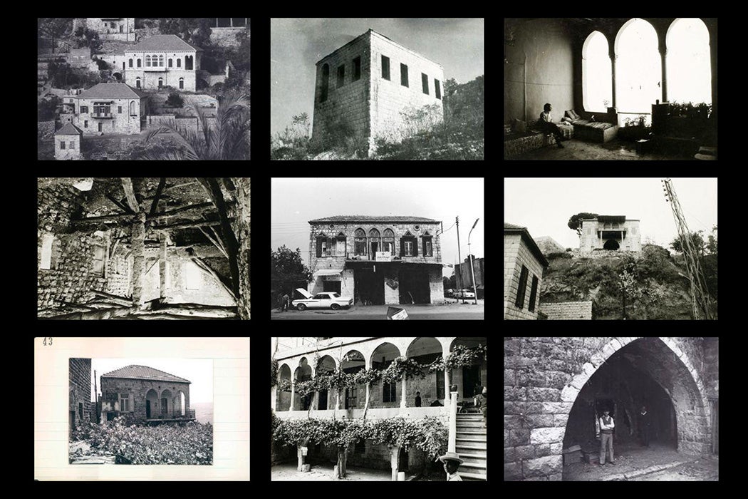
The results of his project comprise the Heinz Gaube Lebanese Architectural Photographs Collection, housed at Notre Dame University-Louaize (NDU) and available via JSTOR. The collection includes 3,100 black-and-white images taken in nearly 300 villages, towns, and cities around the country as well as the negatives and detailed data sheets describing construction techniques, materials, and historical context for each building.
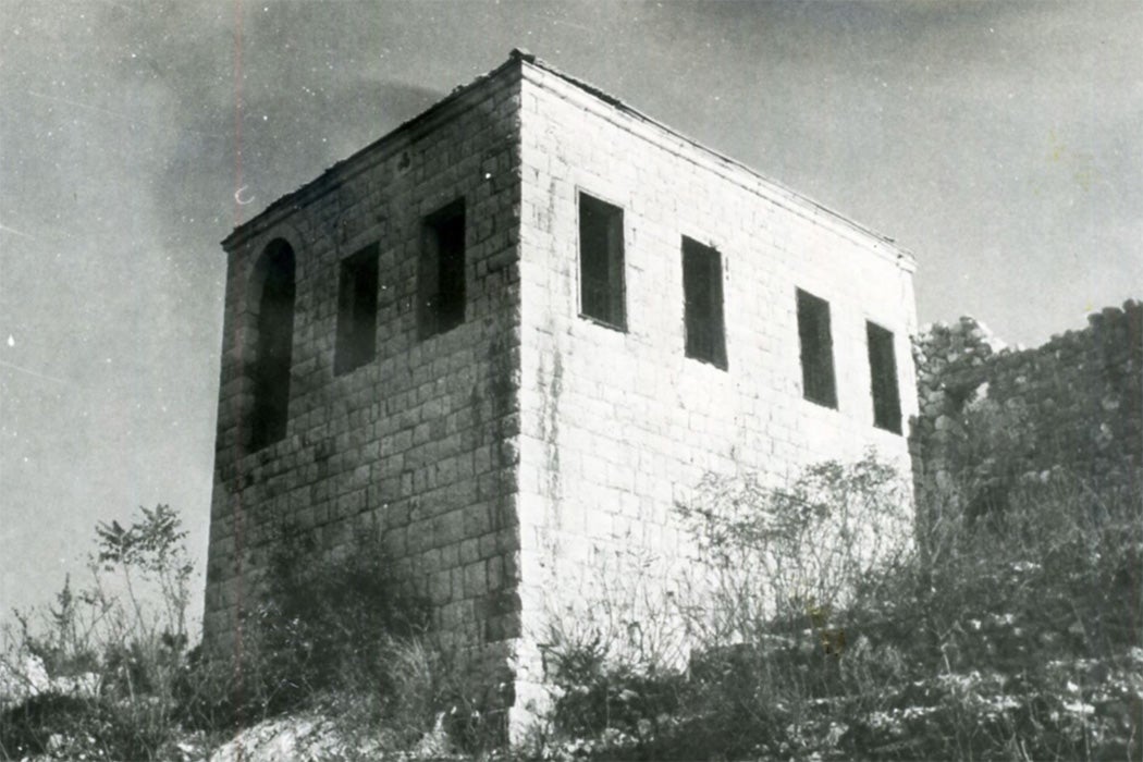
Amine Moussa, the head of Library Information Technology at NDU, tells JSTOR Daily that the collection “is extremely rare and extremely precious because it shows many of the houses that were destroyed and vanished after the war.” That is, some of the properties suffered damage during the war, but others were destroyed because the owners left the country during the conflict.
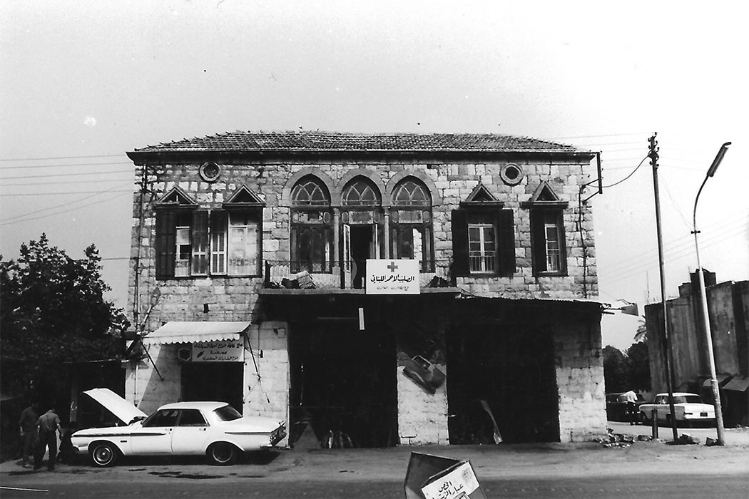
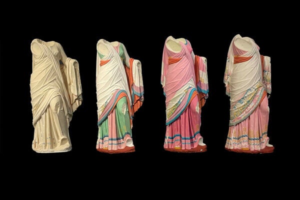
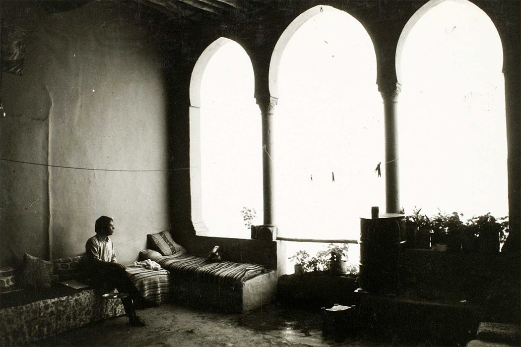
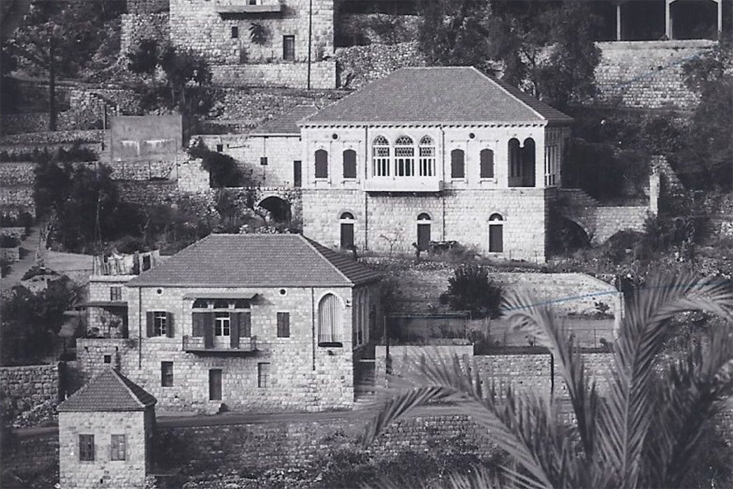
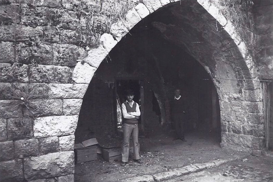
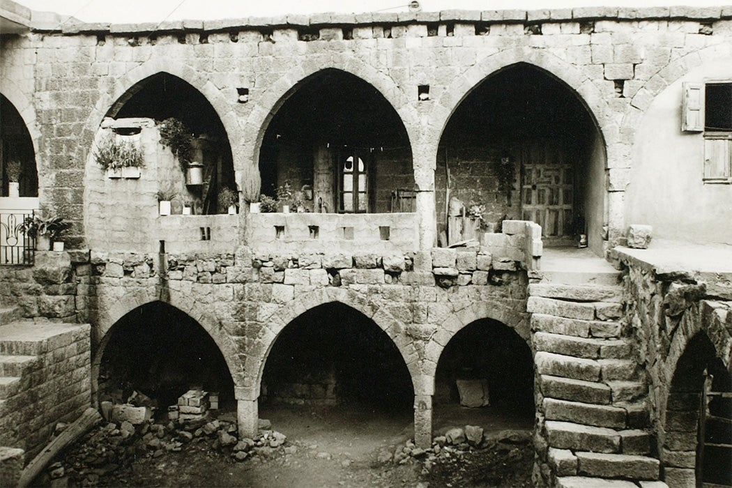
Gaube’s photographs, explains Moussa, show both his interest in vernacular architecture and the penchant of Lebanese architects, designers, and builders for using thick stone and heavy wooden doors that kept interiors cool in summer and insulated in winter. The rectangular homes often contained courtyards or fronting gardens; window boxes hung below wood-frame windows. Most of the houses were topped with a red-tiled hip or pyramidal roof, and even the most modest frequently boasted arcades or variations on the mandaloun window.
The NDU Libraries first acquired the collection in 2009, taking steps to catalogue and digitize the materials. It published the collection on JSTOR six years later. In 2014, a professor of architecture at the university enlisted his students to select a structure from the collection and find it in the “real world” to assess its condition—or whether it still existed at all.
“Each image has its own history,” Moussa says. “We consider them all important.”
Moussa and a former colleague had the idea to give the collection another dimension using geolocation technology to situate the Gaube images on an open access map. Finding one with Arabic transliteration was a challenge that they happily surmounted. Adding search functionality and geolocating the buildings introduced additional complications, as did ensuring the map’s coding communicated with the coding of the NDU website.
“We accessed the X coordinates and Y coordinates of each house in every village,” Moussa says. “The map is zoomable and searchable and the whole map was developed by us—basically the NDU library.”
The project was huge—it took four or five months to create the map—but also a huge success. Moussa reports that architecture students and historians use it and that the map itself has been very well received. In addition to using it for course work, hundreds of students have checked the collection and map to view the buildings from their own villages.
Weekly Newsletter
Moussa is already brainstorming future innovations. For instance, he’s thinking about ways to add “before and after” images for every house. And in terms of search refinement, it may be possible to filter out dwelling that no longer exist, “to see with the graphical interface how many are still there, how many icons disappear from the map” when the filter is applied. That means visiting every building photographed by Gaube, which in itself would be another large task.
Explore the collection further by clicking on the images and map above. More images are available via JSTOR.